


5 Alternative Vermont Hiking Trails Without the Crowds
July 02, 2021
Vermont hiking trails are turning out to be popular places this summer. Trail use at many well-known spots is up, and the Long Trail is experiencing an increase in hikers this year. If you’re in Vermont this summer and looking for a less traveled trail, our friends at the Green Mountain Club shared suggestions for five alternative Vermont hiking trails.
Butler Lodge Loop in Underhill
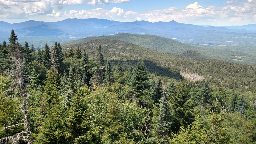
Butler Lodge Loop is a 4.5-mile roundtrip hike with a 1,700-foot elevation gain. The trail is an alternative to Mount Mansfield and offers a variety of terrain with gorgeous views from Mansfield Ridge. Hikers will also find fun rock scrambles, caves, and scenic birch forests. The loop is home to Butler Lodge, which is one of the overnight sites along the Long Trail.
Getting there: From Underhill Center, take Pleasant Valley Road for 0.3 miles north, then turn right on Stevensville Road and travel 2.7 miles to the end. Do not park in travelled portions of this narrow road.
-View from Butler Lodge. Photo courtesy of Rachel Kowalsky/Green Mountain Club
Skyline Trail from Worcester to Middlesex
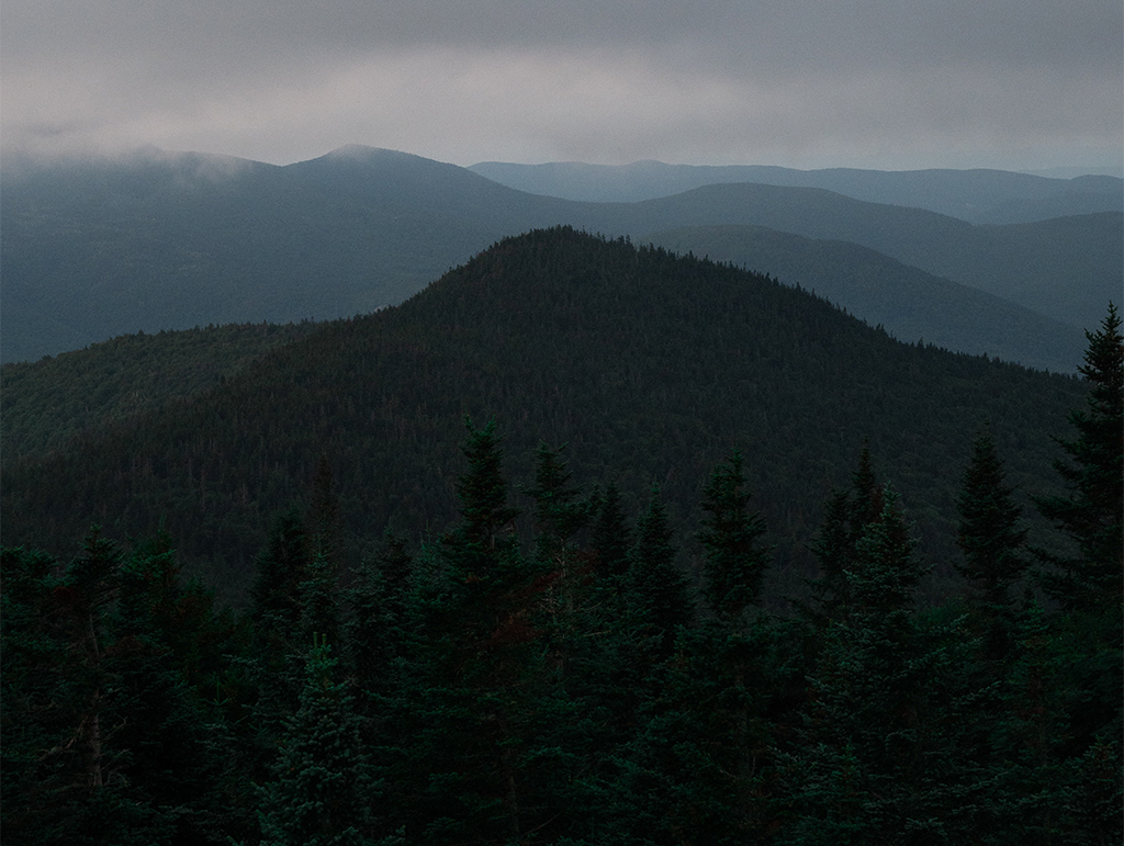
Skyline Trail over the Worcester Range is a 11.9-mile hike with a 2,226-foot elevation gain. This trail connects Worcester Mountain and Mount Hunger and is an alternative to the busier Monroe Skyline trail near Lincoln. Skyline Trail features ridgeline walking that connects to multiple peaks. Use the Worcester Mountain Trail to connect to the Skyline Trail near the summit of Worcester Mountain. The trail then follows the ridge of the Worcester Range to the open, rocky summit of Mount Hunger. The Green Mountain Club recommends descending along the Middlesex Trail.
Getting there:
To the Worcester trailhead: From Route 12 in Worcester, turn onto Minster Brook Road and continue for 1.5 miles. Turn right onto Hampshire Hill Road and continue for 2.5 miles, then turn left onto Mountain Road where the parking area is 0.1 miles ahead.
To the Middlesex trailhead: From Montpelier, head north on VT-12/Elm Street/Worcester Branch Road and continue for 4.9 miles. Turn left onto Shady Rill Road and continue for 2.2 miles. Take a right onto Story Road and continue for 0.7 miles. Turn left onto North Bear Swamp Road and continue for 1.9 miles to the parking area on the right.
-Skyline Trail view. Photo courtesy of Erica Harris/Green Mountain Club
Beaver Meadow Loop in Morristown
The Beaver Meadow-Chilcoot Pass-Long Trail-Whiteface loop is a 7.9-mile roundtrip hike with a 1,472-foot elevation gain. It’s a solid alternative to the ever-popular Camels Hump and offers a challenging and more remote experience.
Starting on the Beaver Meadow Trail, make your way to Beaver Meadow Lodge, which is a recommended place to take a break and eat a snack. From there, hike the Chilcoot Pass Trail, which is a short but steep climb to the Long Trail. Follow the Long Trail north past Hagerman Overlook and soak up views of Mount Mansfield. After climbing over Morse Mountain, you will arrive at the junction of Whiteface Trail. Take the Whiteface Trail back down to Beaver Meadow Trail, which you will follow back to your car.
Getting there: From Route 100 in Morristown, head west on Morristown Corners Road. Travel 0.7 miles and go straight onto Walton Road, then go 0.3 miles and bear left to stay on Walton Road. Continue 0.7 miles on Walton Road to Mud City Loop on the left. Go 2.7 miles on Mud City Loop to Beaver Meadow Road. Park in the winter lot about a mile down Beaver Meadow Road on the right or continue another half mile to the summer parking lot at the end of the road.
-photo courtesy of Clay Kaufmann/Unsplash
Ludlow Mountain/Okemo
If you want panoramic views in your search for alternative Vermont hiking trails, try Ludlow Mountain, a 6-mile roundtrip hike with a 1,943-foot elevation gain at Okemo Mountain Resort. As an alternative to Killington or Pico ski areas, Ludlow Mountain at Okemo features a fire tower at the summit with 360-degree views plus fewer crowds. Follow the blue blazed Healdville Trail as it gradually climbs to the summit of Ludlow Mountain.
Getting there:
From Ludlow: From the intersection of Vermont Routes 100 and 103, head west on Vermont Route 103; turn left on Station Road (2.7 mi). Turn left again just after the railroad tracks (0.8 mi) and park in the lot at the end of the gravel road.
From Rutland: From the intersection of Route 7 and Route 103, head south on Vermont 103; turn right on Station Road for 15 miles. Turn left just after the railroad tracks after 0.8 miles and park in the lot at the end of the gravel road.
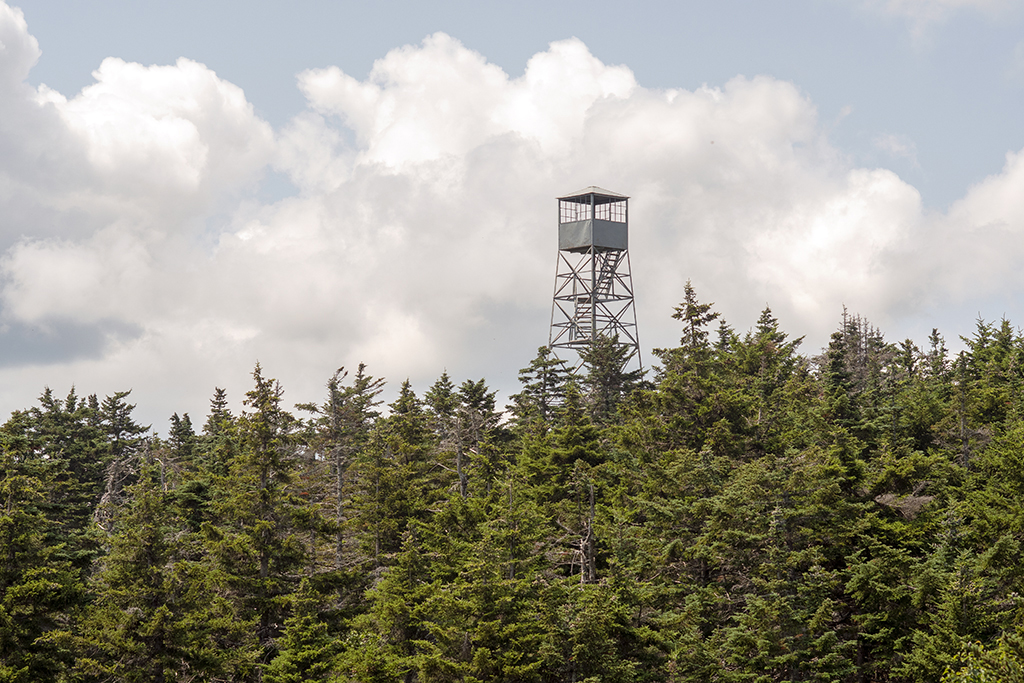
-Fire tower at Ludlow Mountain/Okemo
Branch Pond Trail
In southern Vermont’s Lye Brook Wilderness, the Branch Pond Trail is a 8.6-mile round-trip hike with a 407-foot elevation gain. An alternative to the more popular Stratton Pond, the Branch Pond Trail will take you past two remote ponds and offer views of Stratton Mountain. Here’s a bonus: On your way to the trailhead, you’ll travel along Kelley Stand Road, a gorgeous dirt road in the heart of the Green Mountain National Forest.
Getting there:
From the east: Follow Stratton-Arlington Road from Route 100 west 3.4 miles to the town of Stratton and then another 3.4 miles to the Long Trail parking lot on the north side of the road just before crossing the bridge over the East Branch of the Deerfield River. Continue 2.1 miles past the Long Trail on Stratton-Arlington Road, which becomes Kelley Stand Road at the county line, to the Branch Pond Trail trailhead on the right.
From the west: Take exit 3 (Arlington) off U.S. Route 7 and proceed 0.1 mile west on Route 313 to a right turn onto South Road. Follow South Road 0.6 miles to its end on Kansas Road. Turn right and proceed 0.7 miles to a fork just after crossing a bridge. Take the right-hand fork, Kelley Stand Road, and proceed 8.3 miles from the fork on Kelley Stand Road to the trailhead on the left.
Save the Date: Long Trail Day on Aug. 28, 2021
-photo courtesy of the Green Mountain Club
The Green Mountain Club is announcing plans for Long Trail Day. Hikers can commit to raising $1 for every mile of the 272-mile Long Trail, and get out for a hike on August 28 to celebrate hiking in Vermont.
The Green Mountain Club encourages hikers to get outside and hike the trail and easier side trails to experience the natural beauty, vistas, wildlife, and character of the Green Mountains.
GMC maintains the condition of the trail and its facilities to make hiking in Vermont safe and enjoyable. The 111-year-old organization is inviting Vermonters and visitors to take a hike—solo or with a team—and support the trail by raising $1 per mile of the 272-mile Long Trail.
Proceeds from the 2021 Long Trail Day will benefit GMC’s Long Trail Legacy Campaign, developed as a response to the popularity of outdoor recreation and the need to secure the future of Vermont’s trails.
Learn more about the Green Mountain Club’s Long Trail Day
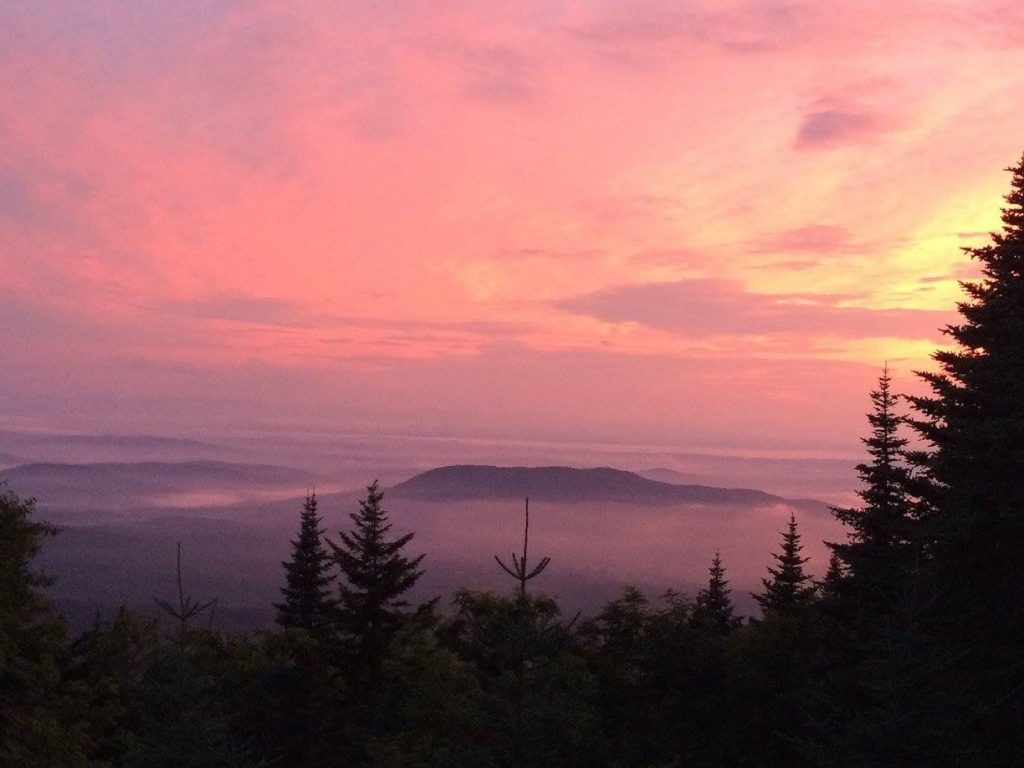
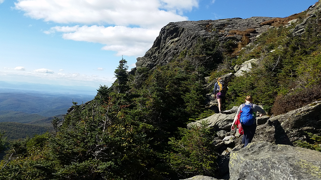
-Main photo courtesy of Patrick Bald/Unsplash
No Comments