
9 Vermont Scenic Drive Alternatives to Route 100
September 10, 2015
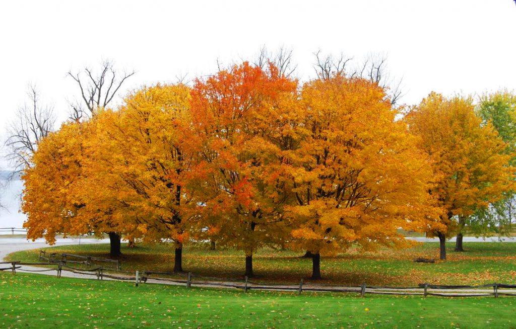
With fall on the horizon, I’m thinking about new scenic drives to explore and returning to some old favorites. In every corner of Vermont, there are hundreds of miles of roads to enjoy. Of course, Route 100 is Vermont’s best known scenic drive – and it lives up to its reputation. But there are also many Vermont scenic drive alternatives to Route 100.
Here are 9 Vermont scenic drive alternatives to Route 100:
Route 30 – Middlebury to Poultney
Route 30 is one of the most underrated scenic roads in Vermont – especially in Addison and Rutland counties. Route 30 starts near the Massachusetts border in Brattleboro and extends to Middlebury. While Middlebury is always a fun destination, make time to see the tiny towns of Cornwall, Whiting, and Sudbury, all located south of the classic New England college town.
As you get farther south, you’ll come to Lake Bomoseen – the largest lake within the state of Vermont – and then arrive in Castleton and Poultney. Castleton and Poultney have beautiful village centers worth stopping for, and you’ll also see plenty of beautiful barns, churches and open fields to enjoy along the way.
Region: Lake Champlain Valley (Addison and Rutland counties)
Getting there: From Route 7 in Middlebury, follow signs for Route 30 south.
Miles: Middlebury to Poultney is 39 miles (one way)
Places of Interest: Middlebury College, Sudbury Congregational Church and Meeting House, Half Moon State Park (open through Columbus Day Weekend), historic Castleton (on Route 4A) and the Poultney Green (on Route 140).
Routes 2 to 114 – Montpelier to Island Pond

It’s hard to go wrong when you’re driving to the Northeast Kingdom in the fall. One of my favorite fall drives is from Montpelier to the northern reaches of Vermont’s most rural region. Foliage arrives a little early in the Northeast Kingdom (the area identified as Caledonia, Essex and Orleans counties), so plan on exploring around Oct. 1 to see the brightest colors.
Region: Central and Northern Vermont (Washington/Caledonia/Essex counties)
Getting there: Take Exit 8 off Interstate 89 toward Montpelier. Head east on Route 2 to Danville to Route 5 in St. Johnsbury. Take Route 5 north to Route 114 in Lyndonville.
Miles: Montpelier to Island Pond is 69 miles (one way)
Places of Interest: The Vermont State House, Marshfield Reservoir, Joe’s Pond, St. Johnsbury Athenaeum, Burke Mountain and Island Pond.
Route 58 through Hazen’s Notch
Not far from Jay Peak is Route 58, which climbs to the east and changes to dirt through Hazen’s Notch in Westfield. Closed in the winter to traffic, Hazen’s Notch is not only beautiful and remote, it’s also an historic route. The notch was named after Moses Hazen — commissioned by George Washington — and his American Revolutionary forces in an attempt to reach St. John.
In 1778-79, Hazen led the construction of the Bayley Hazen Military Road to this part of Route 58 – now marked by a historic site plaque — on a route that started 48 miles to the southeast in Wells River. It was abandoned in April 1779 in Hazen’s Notch when news broke that the British patrols might use it as an invasion route. Who knew a quiet, dirt road could have so much history?
Region: Northern Vermont (Franklin/Orleans counties)
Getting there: Take Route 118 through Montgomery to Route 58
Miles: Route 58 through Hazens Notch is 10 miles (one way)
Places of Interest: Montgomery covered bridges, Jay Peak and The Long Trail
Chelsea Mountain Road to Route 110 in Tunbridge
Chelsea Mountain Road is a meandering dirt road that takes you from East Randolph to Route 110. The mountain road is quiet and steep in places, but less rugged and not as remote as some other highland roads in Vermont.
Once you’re on Route 110, visit Tunbridge’s covered bridges – the Flint Bridge (1845), Larkin Bridge (1902), Mill Bridge (1883; replaced in 2000), Cilley Bridge (1883), and Howe Bridge (1872).
Region: Central Vermont (Orange County)
Getting there: Take Exit 4 off Interstate 89 in Randolph and follow Route 66 east to Route 14 south. Take a left on scenic Chelsea Mountain Road in East Randolph to Route 110.
Miles: Chelsea Mountain Road is 7 miles (one way)
Places of Interest: Floyd’s General Store in Randolph Center, Tunbridge covered bridges and Tunbridge Fairground.
Route 313 in West Arlington to Sandgate Road
Whenever I’m in Manchester, my childhood home, I usually end up spending time in towns along the spine of the Green Mountains – Peru, Londonderry, Weston, and Stratton. But one of the areas I’m most excited to visit again this fall is the western part of Bennington County along the Battenkill River. We used to drive this route to New York State when I was growing up, and it still looks exactly the same as it did 40 years ago.
While you’re on Route 313, head north on Sandgate Road, which takes you around the back of Equinox Mountain and offers a completely new and beautiful perspective.
Region: Southern Vermont/Bennington County
Getting there: Take Route 7A to Arlington and travel west on Route 313. Sandgate Road will be on your right as you’re heading west.
Miles: Route 313 and Sandgate Road are a total of about 14 miles (one way)
Places of interest: West Arlington Covered Bridge, the Battenkill River and the Wayside Country Store.
Route 131 in Cavendish
Windsor County is home to some of the prettiest towns in Vermont – Woodstock, Weston, Plymouth Notch and Chester. Route 100 is also a popular route through this region. But if you’re looking for something different, try Cavendish.
The town is perhaps best known for where Phineas Gage was injured working on the railroad in September 1848, and as the place where exiled Russian author Alexander Solzhenitsyn called home for 17 years.
Region: Southern Vermont (Windsor County)
Getting there: Take Exit 8 off Interstate 91 and travel west onto Route 131 through Weathersfield and onto Cavendish and then Ludlow.
Miles: Route 131 from Interstate 91 to Route 103 in Ludlow is 34 miles
Places of Interest: Cavendish Stone Church, Downers Covered Bridge and Okemo Mountain Resort.
Route 121 in Saxtons River to Grafton to North Windham
I have a soft spot for the tiny village of Saxtons River in the town of Rockingham. The Saxtons River Inn, a vintage 1903 inn with a distinctive square, five-story tower, is a local landmark that’s worth visiting or photographing while you’re in town.
Head west on Route 121 through Grafton – one of Vermont’s most beautiful towns – and you’ll eventually find yourself on a dirt road that leads to North Windham. This is a gorgeous Vermont drive that is not to be missed.
Region: Southern Vermont (Windham County)
Getting there: Take Exit 6 off Interstate 89 in Bellows Falls and follow signs to Route 121 in Saxtons River.
Miles: Route 121 is 27 miles from Saxtons River to North Windham (one way)
Places of Interest: Flat Iron Exchange coffee house in Bellows Falls, Saxtons River Inn, Grafton Inn, Grafton Village Cheese, and Kidder Covered Bridge
Huntington Road
By the time fall arrives, I’m usually planning most of my fall trips outside of the Burlington area. But there are plenty of beautiful, rural roads to check out during the fall season. One of my favorites is Huntington Road. As you head south from Richmond, you’ll see beautiful views of Camels Hump along the way.
The farther south you travel, the more rural the road gets, especially once you pass through the small town of Huntington and head toward Hanksville and Route 17, which will eventually take you over the Appalachian Gap to the Mad River Valley.
Region: Lake Champlain Valley (Chittenden County)
Getting there: Take Exit 11 off Interstate 89 and take Route 2 east toward Richmond. Take a right onto Bridge Street, and then another right onto Huntington Road. Huntington Road turns into Main Road a few miles south of Richmond. The road becomes Gore Road as you get closer to Route 17.
Miles: Huntington Road/Main Road/Gore Road from Richmond to just north of Route 17 is 15 miles (one way)
Places of Interest: Old Round Church, Green Mountain Audubon and Camels Hump State Park
West Shore Road in the Champlain Islands
The nice thing about the Champlain Islands is that it’s one of the last places in Vermont for the leaves to turn, so you can enjoy fall colors well into late October. West Shore Drive in South Hero and Grand Isle hugs the shoreline of Lake Champlain and offers beautiful views of both the Adirondacks and Green Mountains.
The Champlain Islands are located just 30 miles south of the Canadian border in Vermont’s smallest county. Once the leaves are gone in the mountains, the Islands are a welcome bright spot.
Region: Northwest Vermont (Grand Isle County)
Getting there: Take Exit 17 off Interstate 89 and travel on Route 2 west toward the Champlain Islands. Turn left on South Street followed by a right on West Shore Drive.
Miles: West Shore Drive is 9 miles (one way)
Places of Interest: Snow Farm Winery, Hero’s Welcome General Store and St. Anne’s Shrine
What Vermont scenic drive alternatives to Route 100 do you recommend?
Sandy (@CreativeWoodVT)
Posted at 09:12h, 11 SeptemberExcellent options for a fall foliage drive!!
Erica
Posted at 16:12h, 11 SeptemberThanks, Sandy! Looking forward to a beautiful fall season!
Scott
Posted at 15:06h, 11 SeptemberWow. I really hope I can make the trip this Fall. I can’t believe its here again! Thanks for the suggestions!
Erica
Posted at 16:12h, 11 SeptemberI hope so, too, Scott! Hope all is well. Thanks!
jeanne
Posted at 15:35h, 26 Septemberas of today, there is very little foliage in chittenden county. about 2 weeks behind
jamie
Posted at 11:09h, 27 Septemberhey do you know anywhere it has started to change yet? my parents are here for the colors visiting and were sad becuase theyre late changing:(
Erica
Posted at 19:26h, 27 SeptemberHi Jamie — It is definitely delayed. Maybe the Northeast Kingdom up near the Canadian border. But I think it’s pretty late all over.
Erica
Posted at 19:27h, 27 SeptemberHi Jeanne – I know — hope we see some color soon! -Erica
Pingback:7 Reasons We Love Fall in Vermont And You Will Too
Posted at 14:04h, 15 September[…] taken away from the beauty of this change in color. We recommend taking a drive through Vermont’s Route 100 or New Hampshire’s Kancamagus highway for some truly awe-inspiring […]