

Best Vermont Scenic Drives to Get You Outside
July 06, 2019
The options are endless for Vermont scenic drives in the summer and fall foliage season. In every corner of the state, you’ll find gorgeous roads with views of tall mountains, wide open fields, general stores, and rambling old barns. But half the fun of a Vermont scenic drive is getting out of your car to explore the outdoors.
Here are seven recommended Vermont scenic drives that will give you a reason to go for a ride, park your car, and get outside for a while.
The Ultimate Vermont Scenic Drive: Lake Willougby on Route 5A
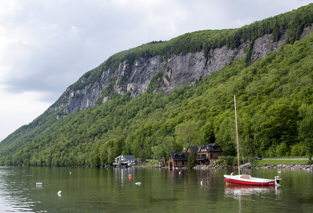
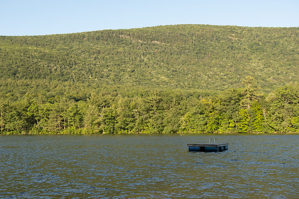
This Vermont scenic drive is roughly a 20-mile route in Northeast Kingdom between West Burke and Derby puts on a spectacular show when you enter the town of Westmore, home to Lake Willoughby. On Route 5A, you’ll travel along the eastern shore of the lake, which is 320-feet deep and resembles a Norwegian fjord.
The dramatic Mount Pisgah rises from the east and Mount Hor to the west. Swimmers can access the water at both ends of the lake (there’s a nude beach at the South West Cove of the lake). At the southern end of the lake is Willoughby State Forest, where there are miles of hiking and recreational trails, offering glorious views of the lake, nearby mountains, and beyond.
Southern Vermont Charm on Routes 121 and 35
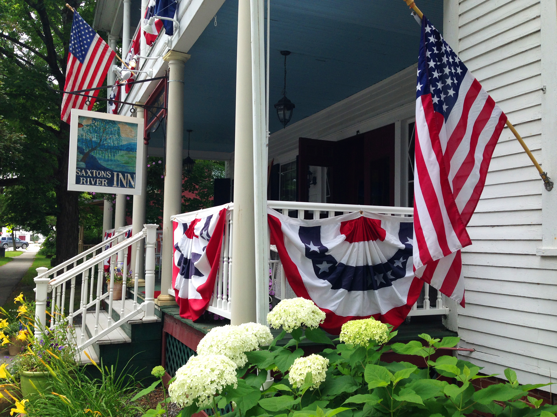
Windham County in southern Vermont has some of the best scenic roads in Vermont. West of the Connecticut River just off Route 103 (Exit 6 off Interstate 91) is the Rockingham Meeting House, the oldest unchanged public building in Vermont built in the late 1700s and has since been beautifully restored.
From there, take Pleasant Valley Road to the sweet village of Saxtons River. Then follow Route 121 to scenic Grafton, one of the prettiest towns in Vermont. Once you arrive in Grafton, walk around the village, which is home to The Nature Museum, the MKT Grafton general store, Grafton Village Cheese and the Grafton Inn. If you want to go the extra mile and break a sweat, head over to the Grafton Trails & Outdoor Center for hiking, biking, swimming, or canoeing. From there, take Route 35 north to Chester or south to Townshend.
The Notch: Vermont Scenic Route 108 in Stowe
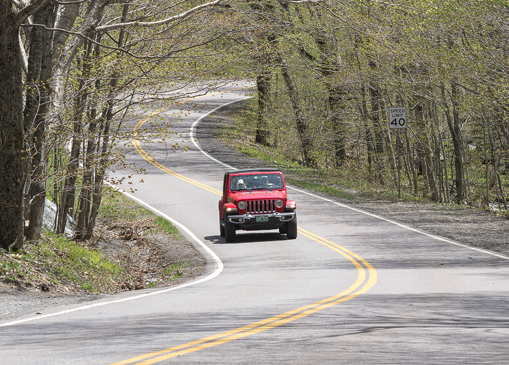
Route 108, also known as the Notch, connects Stowe and Jeffersonville and is a very popular Vermont scenic drive. The road has an otherworldly feel with giant boulders, thousand-foot cliffs, hairpin turns, and thick forests. In the summer and fall, thousands of visitors descend upon the Notch to hike, rock climb, and camp.
Before Route 108 was built in the early 1920s, a footpath and horse trail crossed The Notch. The Notch was used to illegally transport goods to Canada in the 19th century, and to smuggle alcohol during Prohibition. These days, the road is closed to vehicular traffic between November and May—so summer and fall foliage are prime seasons to explore. Be sure to park at the top of Route 108 and access a trail across from the information booth to hike to Sterling Pond—the highest trout pond in the state.
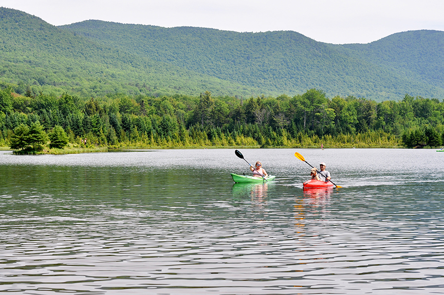
Explore Vermont’s Lake Dunsmore: Route 53 in Salisbury
Route 53 winds around Lake Dunmore at the foot of Mount Moosalamoo in Salisbury. Summer cottages dot the shoreline of this 1,000-acre scenic lake, as does Branbury State Park, featuring a sandy beach, swimming, boat rentals, overnight camping, and more.
Hike to the Falls of Lana or Silver Lake, which are part of the 16,000-acre Moosalamoo National Recreation Area. In 2007, the federal New England Wilderness Act designated the Moosalamoo region as a National Recreation Area, joining 44 other federal National Recreation Areas nationwide. Off the Vermont scenic drive of Route 53 are miles of forest roads in Moosalamoo, a gorgeous area ideal for hiking, camping, mountain biking, or just reconnecting with nature.
Beauty in the Mad River Valley: East Warren Road
Off Route 100 in the Mad River Valley is East Warren Road, where you’ll find stunning views of Lincoln Peak and Mount Ellen. Start this Vermont scenic drive in Waitsfield on Bridge Street and pass through a one-lane covered bridge. Along the way you’ll see a historic round barn, pastures, farm houses, Sugarbush and Mad River Glen ski trails, and plenty of beauty.
Follow East Warren Road to Brook Road, which winds down into scenic Warren Village, home to The Warren Store and The Pitcher Inn. If you’re looking for outdoor activities, take East Warren Road to Brook Road to Plunkton Road, and head over to Blueberry Lake for swimming or kayaking, or to the nearby Blueberry Lake mountain bike trails.
A Vermont Covered Bridge and Country Store on Route 313 in Arlington
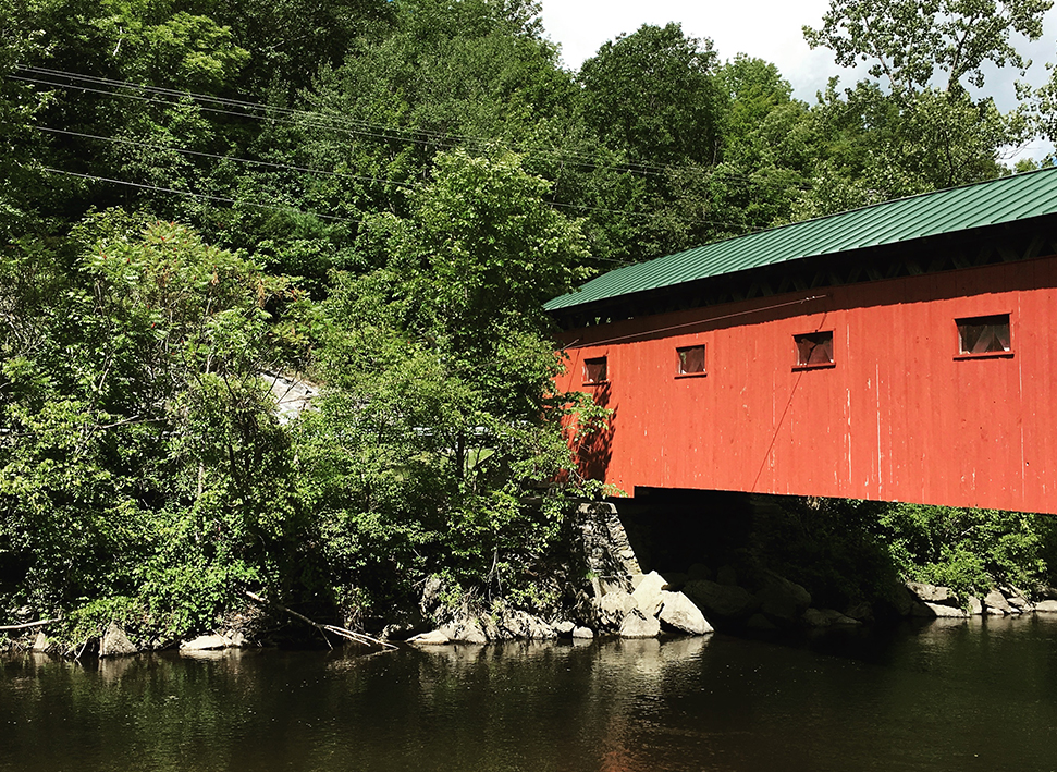
Between Arlington and the New York state line is Route 313, which winds along the Battenkill River for about 10 miles. The Vermont scenic drive feels the same as it did 40 years ago. That’s when the new Route 7 was built as a bypass and Route 313 became far less traveled by trucks and commercial traffic.
When you’re on Route 313, stop by the Wayside Country Store or head up Sandgate Road, where you’ll see a tiny town hall, a Methodist church, and a few houses along the western side of Mount Equinox. The best part of Route 313 are pull-offs where you can drop in the Battenkill River to fly fish (catch-and-release only), go tubing, kayaking or canoeing.
Closer to the New York border is the West Arlington Covered Bridge, which was built in 1852 and is close to the former home of Norman Rockwell. The bridge is also popular swimming spot and access point. If you’re looking to spend some time exploring in the Battenkill, tube and kayak rentals are available from outfitters such as Big Big on the Battenkill, or you can hire a fishing guide through Orvis.
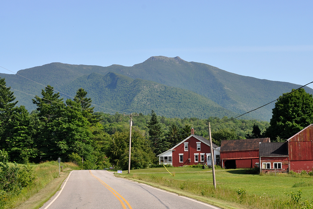
Views of Mount Mansfield on Pleasant Valley Road in Cambridge
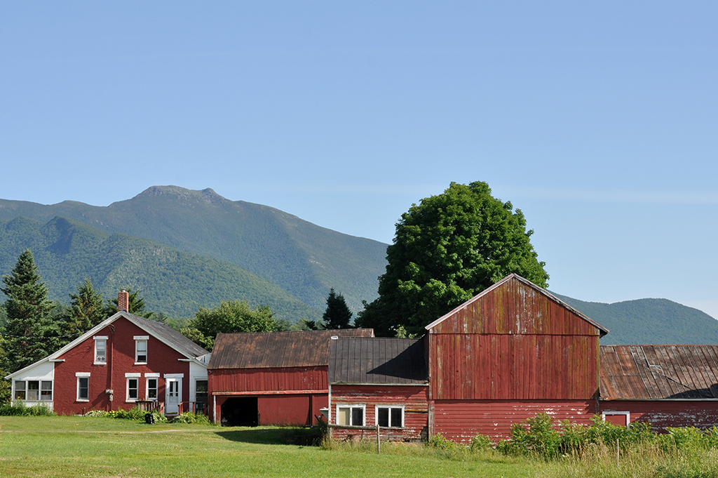
Pleasant Valley Road, located between Cambridge and Underhill, is a road worth exploring in northern Vermont. Take this Vermont scenic drive in the early morning hours or late afternoon as the best views of Mount Mansfield are to the east. Pleasant Valley Road is a short and sweet 10-mile stretch connecting Cambridge and Underhill.
Heading south from Cambridge, Pleasant Valley Road offers Vermont’s most dramatic view of Mount Mansfield, Vermont’s tallest peak. You won’t see ski trails on this side of Mount Mansfield, but Pleasant Valley Road highlights the mountain’s rugged contours and rocky summit. In the shadow of Mount Mansfield along Pleasant Valley Road are barns, farms, and wide open meadows. Near Underhill Center is Underhill State Park, which offers hiking trails to the summit of Mount Mansfield.
What are some of your favorite Vermont scenic drives?
Janet
Posted at 12:08h, 10 JulyI’m bookmarking this for our next visit! Thank you
Siri Suursoo
Posted at 15:31h, 12 JulyYou will not regret it… Routes 12 and 100 in Central Vermont are the best….
Erica
Posted at 12:06h, 22 JulySo true! Thanks, Siri.
Erica
Posted at 12:06h, 22 JulySo happy to hear this, Janet! Have FUN! -Erica
Pingback:Why Pleasant Valley Road is Vermont's Most Beautiful Road
Posted at 13:55h, 12 January[…] I had to pick just one road in Vermont as the ultimate scenic drive, it would be Pleasant Valley Road in […]